Voluntary Stewardship Program
VSP
For agricultural landowners, the Voluntary Stewardship Program (VSP) is our opportunity to show that Ferry County can achieve natural resource laws through voluntary cooperation, as opposed to regulation. By participating in VSP, you take credit for past and future conservation activities on your property — which helps our community avoid one-size-fits-all mandates for environmentally critical areas — and you gain access to funding for additional farm-friendly natural resource projects.
The June 2025 quarterly VSP meeting featured an insightful presentation on Virtual Fencing by VENCE. This recording provides comprehensive information on the potential applications of Virtual Fencing in Ferry County. Discover how this innovative technology can enhance land management and improve livestock safety in our community. Don't miss out on the valuable insights shared during this session!
Why Are There Laws for Environmentally Critical Areas?
By law, all counties are required to protect environmentally critical areas, including on agricultural lands. The State gave each county a choice for how they will meet this law:
Option 1: One-size-fits-all regulations through the Growth Management Act.
Option 2: Incentive-based approach through VSP.
Ferry County opted for the VSP approach. However, we as a community must demonstrate that we're meeting goals for protecting environmentally critical areas on ag lands voluntarily or we may be forced into the regulatory approach.
Why VSP is in Your Best Interest
-
VSP helps you continue to farm and ranch your way.
-
Taking credit for conservation work you have done or plan to do helps our entire county avoid regulatory mandates. But, if farmers keep their stewardship a secret, Ferry County may be forced into a regulatory approach to meet critical area laws.
-
VSP participants gain access to funding to help cover some of the costs for eligible, farm-friendly conservation projects that you want to do.
What Are Critical Areas?

Wetlands
Wetlands are fragile ecosystems that serve a number of important beneficial functions. Wetlands assist in the reduction of erosion, siltation, flooding, ground and surface water pollution, and provide wildlife, plant, and fisheries habitats. Wetlands destruction or impairment may result in increased public and private costs or property losses.

Frequently Flooded Areas
Floodplains and other areas subject to flooding perform important hydrologic functions and may present a risk to persons and property. Classifications of frequently flooded areas should include, at a minimum, the 100-year floodplain designations of the Federal Emergency Management Agency and the National Flood Insurance Program. Historic losses to salmon habitat have occurred as a result of development encroaching into floodplains. In addition to minimizing adverse effects to human health, safety and infrastructure, floodplains are ideal locations for salmon habitat restoration.

Critical Aquifer Recharge Area
Water is an essential life-sustaining element. Much of Washington’s drinking water comes from ground water supplies. Once ground water is contaminated it is difficult, costly, and sometimes impossible to clean up. Preventing contamination is necessary to avoid exorbitant costs, hardships, and potential physical harm to people. The quality of ground water in an aquifer is inextricably linked to its recharge area. Where aquifers and their recharge areas have been studied, counties and cities should use this information as the basis for classifying and designating critical aquifer recharge areas. Where no specific hydrogeologic studies have been done, counties and cities may use existing soil, surficial geologic and well log information to determine where recharge areas are likely to be located.

Geologically Hazardous Areas
Geologically hazardous areas include areas susceptible to erosion, sliding, earthquake, or other geological events. They pose a threat to the health and safety of citizens, fish, and wildlife, when incompatible commercial, residential, or industrial development is sited in areas of significant hazard. Some geological hazards can be reduced or mitigated by engineering, design, or modified construction or mining practices so that risks to health and safety are acceptable. When technology cannot reduce risks to acceptable levels, building in geologically hazardous areas is best avoided. This distinction should be considered by counties and cities that do not now classify geological hazards in their critical areas ordinance. Counties and cities should also consider classifying geologically hazardous areas as either known or suspected risk, no risk, or unknown where data are not available to determine the presence or absence of a geological hazard.

Fish and Wildlife Habitat Conservation Areas
Fish and wildlife habitat conservation is the management of land for maintaining species in suitable habitats within their natural geographic distribution so that isolated subpopulations are not created. This does not mean that all individuals of all species must be maintained at all times, but it does mean cooperative and coordinated land use planning is critically important among counties and cities in a region.
I Want to Farm My Way - How Do I Participate in VSP?
Step 1
Identify if your property has any of the five critical areas listed above. If you're unsure, the Ferry CD team is here to help (509-775-3473).
Step 2
Submit the Ferry County VSP Form to take credit for conservation you've already done and/or plan to do.
Step 3
If you find yourself in need of improvements, our technical staff will work with you to produce an Individual Stewardship Plan at NO CHARGE and connect you with financial resources as needed.
Step 4
Keep up to date on VSP progress by checking the resources on this page, and by attending quarterly VSP work group meetings.
What Type of Conservation Activities Contribute to VSP?
-
Livestock and Range Management:
-
Reseeding Mixed-Use Pasture Land (e.g., provide or improve forages for livestock)
-
Prescribed Grazing (e.g., rotational grazing)
-
Spring Development
-
Watering Facility (e.g., off-site watering tank)
-
-
Forest Understory Management:
-
Tree/Shrub Pruning
-
Woody Residue/Forest Slash Treatment (e.g., prescribed burning)
-
Forest Stand Improvement (e.g., thinning)
-
-
Nutrient and Pest Management
-
Pest Management (e.g., weed spraying)
-
-
Soil Management:
-
Conservation Crop Rotation
-
-
Irrigation Management:
-
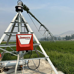
Irrigation System, Sprinkler (e.g., change from handline to a pivot)
-
Irrigation Water Management (e.g., adjust to more efficient sprinkler heads)
-
-
Habitat Management:
-
Riparian Forest Buffer (e.g., the vegetative area around a body of water)
-
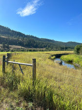
Access Control (e.g., fencing off area from animals)
-
Tree/Shrub Establishment (e.g., reseeding)
-
Restoration and Management of Rare and Declining Habitats (e.g., wildlife brush pile)
-
Fish and Wildlife Structure (e.g., removal of fish barrier)
-
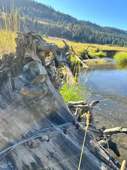
Streambank and Shoreline Protection (e.g., root wads along streams)
-

More Information

-
Before 2011, the main tool for counties to ensure the protection of critical areas on agricultural land was regulation.
-
Regulation of agricultural landowners can threaten farm viability and lead to legal battles.
-
VSP was created in 2011 to give counties the option to use locally driven watershed plans and voluntary, incentive-based tools to protect critical areas on ag. land.


.jpg)